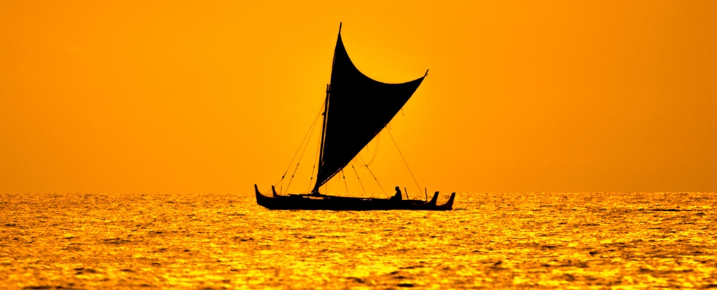
Drenched and chilled, I disembarked from the outrigger of a Polynesian voyaging canoe. We had been at sea for the entire afternoon and a significant portion of the night.
My hope of obtaining some respite was thwarted by the relentless rain, strong winds, and a stark lack of level surfaces, rendering any attempt at sleep futile. My fellow travelers did not even bother to try.
The year was May 1972, and I was three months into my doctoral research on one of the planet’s most isolated islands. Anuta stands as the easternmost inhabited outlying settlement in the Solomon Islands archipelago.
Measuring merely half a mile in diameter, situated 75 miles (120 kilometers) from its closest inhabited neighbor, it persists as one of the few communities where travel between islands via outrigger canoes is a customary practice.
My gracious hosts orchestrated a bird-hunting expedition to Patutaka, a desolate, towering rock formation located 30 miles distant, and extended an invitation for me to join their venture.
Our journey to the designated location spanned 20 hours, followed by a two-day stay, after which we set sail homeward, propelled by a robust 20-knot aft wind. This expedition ultimately paved the way for decades of anthropological investigation into the methods employed by Pacific Islanders to navigate the vast expanse of the open ocean aboard diminutive vessels, entirely devoid of “modern” navigational equipment, and to reach their intended endpoints with assured safety.
The techniques for wayfinding are diverse, contingent upon specific geographical and environmental circumstances. Nevertheless, many principles are universally applied. These encompass the mental charting of islands within the mariners’ navigational cosmos and the precise positioning of potential destinations relative to the celestial movements, ocean currents, prevailing winds, and wave patterns.
Western fascination with Pacific seafaring
The recent cinematic releases of Disney’s two “Moana” features have cast a renewed spotlight on Polynesian voyaging traditions. However, the admiration of Europeans for Pacific mariners stretches back through the centuries.
In the year 1768, the French explorer Louis Antoine de Bougainville bestowed upon Sāmoa the appellation of the “Navigators’ Islands.” The renowned British captain, James Cook, observed that the Indigenous canoes possessed a speed and maneuverability comparable to his own vessels. He extended hospitality to Tupaia, a master navigator hailing from Ra’iātea, aboard his ship and meticulously documented Tupaia’s profound geographical erudition.
In 1938, the distinguished Māori scholar Te Rangi Hīroa, also known as Sir Peter Buck, authored “Vikings of the Sunrise,” a seminal work that elucidated the narrative of Pacific exploration as depicted in Polynesian lore.
In 1947, Thor Heyerdahl, a Norwegian explorer and amateur archaeologist, embarked on a transatlantic voyage from Peru to the Tuamotu Islands aboard a balsa wood raft christened the Kon-Tiki, thereby igniting further curiosity and inspiring a series of experimental maritime expeditions.
A decade later, Andrew Sharp, a historian based in New Zealand and a prominent skeptic, posited that accurate navigation across vast ocean distances without the aid of instruments was an impossibility. This assertion was subsequently countered by numerous ethnographic studies that provided compelling evidence that such voyages were not only historical realities but also ongoing practices.
In 1970, Thomas Gladwin presented his findings concerning the Micronesian island of Polowat in his publication “East Is a Big Bird.” Two years thereafter, David Lewis’s seminal work “We, the Navigators” meticulously chronicled the wayfinding methodologies employed across a substantial portion of Oceania.
A considerable cohort of anthropologists, in conjunction with Indigenous mariners, has built upon the foundational research established by Gladwin and Lewis.
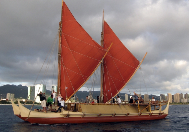
A final significant avenue of inquiry has been the realm of experimental voyaging. Foremost among these endeavors is the contribution of the Polynesian Voyaging Society. This organization commissioned the construction of a double-hulled voyaging canoe, named Hōkūle’a, fabricated using contemporary materials while adhering to traditional design principles.
In 1976, under the guidance of the Micronesian navigator Mau Piailug, they successfully navigated the Hōkūle’a over a distance of 2,500 miles, from Hawai’i to Tahiti, without the utilization of any instruments. Subsequently, in 2017, the Hōkūle’a achieved the remarkable feat of completing a circumnavigation of the globe.
When traversing the Earth’s largest ocean, it is possible to cover thousands of miles and encounter nothing but an uninterrupted expanse of sky and water in every direction. In the absence of a magnetic compass, let alone GPS technology, how can accurate navigation to a predetermined destination be achieved?
Celestial guidance
The majority of Pacific voyagers depend upon celestial bodies for their navigation. The stars ascend from the eastern horizon, descend in the west, and, in proximity to the equator, trace a predictable latitudinal path. Should a familiar star rise or set directly above the intended island, the helmsman can precisely calibrate the vessel’s course with that celestial marker.
However, this process is not without its complexities.
The specific stars observable, along with their points of rising and setting, undergo alterations throughout the annual cycle. Consequently, effective navigation necessitates a profound understanding of astronomical phenomena.
Furthermore, celestial bodies are in perpetual motion. A star positioned directly overhead the target island will soon either ascend beyond a useful altitude or descend beneath the horizon. Thus, a navigator must identify alternative stars that follow a comparable trajectory and maintain observation of them as long as they remain visible and low on the horizon. Such a succession of guiding stars is frequently referred to as a “star path.”
It is important to note that stars may not always align perfectly with the desired destination. In such scenarios, rather than steering directly towards the guiding star, the navigator maintains it at a calculated angle.
A navigator must continuously adjust the vessel’s alignment with the stars to counteract the drift caused by currents and winds, which can impel the canoe laterally. This lateral movement is known as leeway. Therefore, celestial navigation demands a thorough comprehension of the currents’ presence, velocity, force, and direction, as well as the ability to accurately assess the winds’ intensity, bearing, and their impact on the canoe’s trajectory.
During daylight hours, when stars are obscured, the Sun can serve a comparable navigational function. In the early morning and late afternoon, when the
The position of the sun relative to the horizon serves as a crucial navigational aid for mariners attempting to ascertain their course. However, atmospheric conditions, such as cloud cover, can intermittently obscure celestial bodies, necessitating reliance on alternative navigational cues by those at sea.
Maritime Indicators Beyond Celestial Navigation
A paramount navigational determinant is the presence of swells. These are generated by sustained winds that traverse vast expanses of open ocean. Unlike localized or transient wind patterns, which sculpt waves of varying characteristics designated as “seas,” swells maintain a consistent direction of propagation.
The helmsman, by perceiving the rhythmic motion of swells beneath the vessel, can accurately discern the correct course, even in conditions of limited visibility. In certain oceanic regions, up to four distinct swell systems may be concurrently present, which experienced voyagers can differentiate based on their magnitude, form, intensity, and orientation relative to the prevailing wind.
Upon approaching a destination island, though still beyond visual range, the precise location must be pinpointed. A common method involves observing reflected waves: swells that impinge upon the island and subsequently rebound seaward. The navigator, sensing these returning wave patterns, steers the vessel toward their source. Navigators indigenous to the Pacific, whose lives have been intimately connected with the ocean, exhibit remarkable confidence in their ability to utilize reflected waves. In contrast, the author finds these wave phenomena challenging to distinguish from those directly induced by wind forces.
Avian species that engage in both terrestrial nesting and marine foraging also provide valuable navigational information. Observations in the early morning suggest these birds are departing from land, while their return journey in the late afternoon indicates they are heading back to their roosts.
Navigators might also detect a subtle verdant hue in the sky directly above an obscured island. Atmospheric phenomena, such as cloud formations, can coalesce over volcanic landmasses.
Furthermore, mariners in the Vaeakau-Taumako region of the Solomon Islands have reported the presence of submerged luminous streaks, known as “te lapa,” which they assert indicate the direction of distant islands.
A prominent researcher has voiced strong conviction regarding the veracity and practical utility of te lapa. Some academic circles have posited that this phenomenon could be attributed to bioluminescent activity or electromagnetic interactions. Conversely, the author, despite a dedicated year of investigation, was unable to substantiate its existence.
The accurate determination of one’s position whilst at sea presents a perpetual challenge. The predictable movement of stars along defined celestial parallels facilitates the calculation of latitude. Conversely, ascertaining longitude necessitates the application of dead reckoning methodology. This involves navigators meticulously charting their course by recording their point of origin, directional heading, velocity, and duration of travel.
Certain Micronesian navigators employ a conceptual framework known as “etak” to estimate their progression. This system involves the visualization of the angular relationship between their vessel, perceived as static, and a reference island that is depicted as moving relative to the canoe. Western academics have put forth theories concerning the operational principles of etak, but a definitive understanding remains elusive.
For eons, Pacific voyagers have successfully navigated to myriad islands, scattered across the Earth’s most extensive ocean, by employing such sophisticated techniques. Their achievements were accomplished without the aid of conventional Western navigational instruments. Instead, they possessed profound knowledge and intricate understandings, transmitted orally through numerous generations.